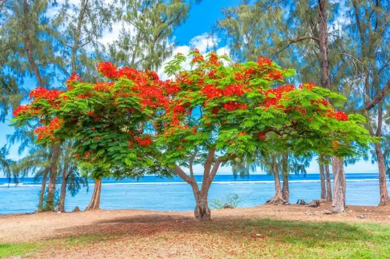
Reunion Island — Volcano, Cirques, Lagoon & Creole Culture
Reunion Island, the intense island of the Indian Ocean, combines everything travelers love about tropical destinations in a single journey:
- an active volcano you can visit,
- three dramatic cirques classified by UNESCO,
- a turquoise lagoon perfect for swimming,
- deep tropical rainforests,
- a rich and vibrant Creole culture.
As a French overseas department in the Mascarene Archipelago, Reunion Island neighbors Mauritius and Rodrigues.
Reunion Island Essentials at a Glance
- Highest point: Piton des Neiges (3,071 m / 10,075 ft)
- Active volcano: Piton de la Fournaise (2,632 m / 8,635 ft) — access regulated based on activity
- UNESCO World Heritage Site: “Pitons, Cirques and Remparts” in the heart of the National Park
- Currency / Language: Euro, French & Creole
- Average tourist stay duration: ≈ 20 days (regional observatory)
Why Choose Reunion Island… Year-Round?
Every month offers its own advantages on La Reunion: lush landscapes and full waterfalls during the austral summer rainy season (November to April, 26-30°C/79-86°F on the coast), vast horizons and cooler air on the ridges during austral winter (May to October, 20-25°C/68-77°F), golden light and welcoming seas during the shoulder seasons (April-May and October-November).
Within a single day, you can go from the western lagoon and white sand beaches to the cool highlands (10-15°C/50-59°F at altitude) and the frozen lava flows of the wild south. This continuous diversity makes Reunion Island an inspiring Indian Ocean destination twelve months a year.

Top Things to See and Do in Reunion Island
Piton de la Fournaise Volcano
From Pas de Bellecombe–Jacob, you enter a mineral landscape where lava flows, tunnels, and secondary craters tell the story of a still-active volcano. The route is marked and may be closed during eruptions or alerts: check conditions the day before, leave early, and bring proper equipment (water, windbreaker, hiking shoes).
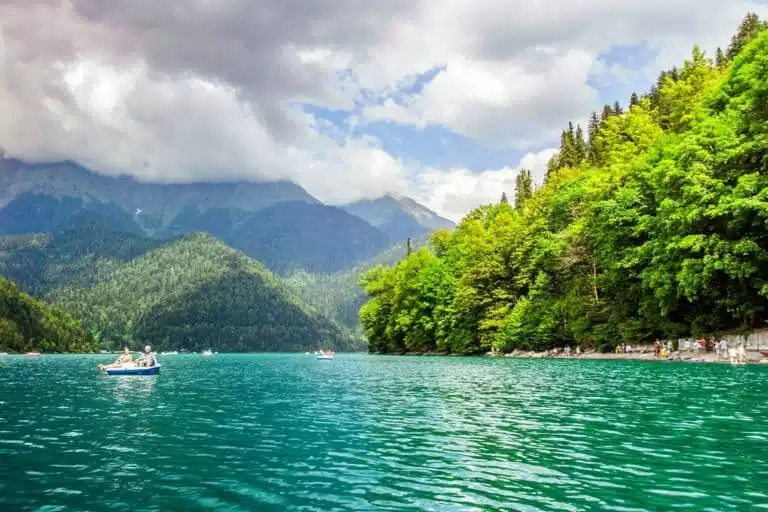
The Three UNESCO-Listed Cirques of Reunion Island
- Mafate Cirque — hikers’ paradise, no roads: accessible only on foot (Col des Bœufs, Maïdo, Rivière des Galets) or by helicopter. Between islets, guesthouses, and balcony trails, the experience is unique.
- Cilaos Cirque — the 400-bend road climbs to thermal baths, vineyards, and mountain ridges. It’s also one of the gateways to Piton des Neiges.
- Salazie Cirque — the greenest: the Bridal Veil waterfall, traditional houses of Hell-Bourg, misty forests of Bélouve.
Waterfalls, Ravines & Natural Pools
Grand Galet/Langevin, Takamaka, Bassin la Paix, Bassin la Mer, Bélouve viewpoint over Trou de Fer: the meeting of water and terrain creates spectacular scenes. Some natural pools allow swimming — follow local signage.
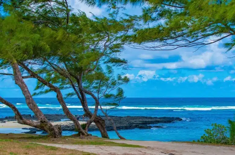
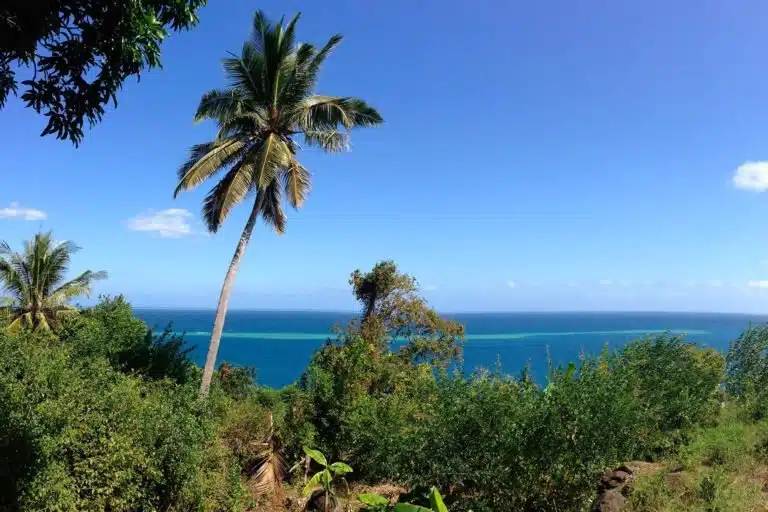
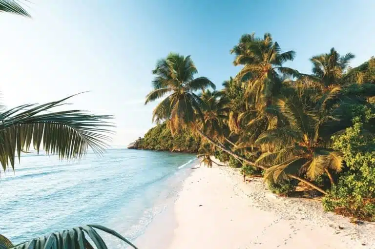
Beaches, Lagoon & Coastline (West & South)
On Reunion Island, the sea has two complementary faces. In the West, the coral reef creates a calm, clear lagoon, perfect for swimming, paddling, and observing tropical fish. Further South, the coastline becomes spectacular: cliffs, frozen lava flows, palm-fringed coves, and viewpoints swept by trade winds. Everywhere, enjoy the light and sunsets — while respecting signage and choosing supervised areas.
West Coast — The Turquoise Ribbon
From Saint-Gilles-les-Bains to La Saline-les-Bains and Trou d’Eau, the lagoon offers shallow waters ideal for snorkeling and family swimming. At Boucan Canot, a large beach open to the ocean, alternate swimming when the area is authorized and supervised, beachfront restaurants, and end-of-day atmosphere.
Nearby, Roches Noires / Les Brisants animates central Saint-Gilles. Further south, Saint-Leu combines lagoon for snorkeling, walks to Pointe au Sel, and paragliders landing on the sand.
South Coast — Character and Panoramas
Near L’Étang-Salé, the large black sand beach borders the coastal forest: walking, viewpoints, and swimming only when authorized and supervised.
Saint-Pierre offers a friendly urban beach and small family lagoon, with a lively waterfront at blue hour. A few minutes away, Grande Anse (Petite-Île) unfolds a postcard bay shaded by coconut palms; a developed pool south of the beach allows refreshing dips when conditions permit. At Manapany-les-Bains, a natural rock pool offers an intimate setting.
Elsewhere on Reunion Island?
The wild South (Sainte-Rose → Saint-Philippe) is worth visiting for its panoramas — Cap Méchant, coastal lava flows, screw pines — more for contemplation and trails than swimming. In the North and East, the more exposed coast invites walking and river pools rather than ocean swimming; for swimming, choose the West lagoon.
Useful Recommendations
- Swim only in the lagoon and supervised areas.
- Conditions (swell, currents, openings/closures) change: follow signage and lifeguards.
- In the lagoon: preserve reef life — don’t walk on coral, don’t touch anything, choose “reef-safe” sunscreen.
Reunion Island’s 3 Cirques: Which to Choose?
| Cirque | Access | Characteristic | Ideal For | Accommodation |
|---|---|---|---|---|
| Cilaos | ⭐⭐ 400-bend road (2h30 from Saint-Denis) |
Thermal baths, vineyards, high ridges | Families, wine lovers, hikers | Many hotels & guesthouses |
| Salazie | ⭐⭐⭐ Easy road (45min from Saint-Denis) |
Lush, waterfalls, forests | Beginners, photography, families | Accessible villages, several options |
| Mafate | ⭐ On foot only (3-6h hiking) |
Wild, isolated, authentic | Experienced hikers, adventurers | Rustic guesthouses (booking required) |
Hiking in Reunion Island: Which Trail for My Level?
| Difficulty | Hike | Duration | Elevation | Scenery |
|---|---|---|---|---|
| ⭐ Easy | Bassin la Paix | 1h round trip | 100m | Waterfall & swimmable pool |
| ⭐ Easy | Bridal Veil | 30min round trip | Flat | Iconic Salazie waterfall |
| ⭐⭐ Moderate | Piton de la Fournaise (Dolomieu crater) | 5-6h round trip | 500m | Lunar landscape, active crater |
| ⭐⭐ Moderate | Maïdo Viewpoint | 2-3h round trip | 300m | Panoramic view over Mafate |
| ⭐⭐⭐ Difficult | Piton des Neiges (summit) | 7-9h round trip | 1700m | Indian Ocean highest point, sunrise |
| ⭐⭐⭐ Difficult | Mafate (cirque loop) | 3-5 days | Variable | Wild cirque, isolated islets |
What to Do in Reunion Island: Activities by Traveler Type
🥾 For Hikers
- Mafate trek (3-5 days): discover the islets of La Nouvelle, Marla, Roche Plate
- Piton des Neiges: summit ascent (3,071 m) for sunrise
- Volcano loop trail via Piton Kapor and the enclosure ridges
- Coastal trail: Grande Anse to Manapany (coastal landscapes)
- Trou de Fer: Bélouve viewpoint over this vertiginous canyon
👨👩👧👦 For Families
- L’Ermitage Lagoon: easy snorkeling, shallow waters
- Kélonia (Saint-Leu): aquarium and sea turtle care center
- Cité du Volcan: interactive museum with 4D cinema on volcanic activity
- Stella Matutina (Saint-Leu): sugar and Reunion Island history museum
- Accessible pools: Bassin la Paix, Langevin (supervised swimming)
- Colorful markets: Saint-Paul (Friday-Saturday), Saint-Pierre (Saturday)
- Lava tunnels: family-friendly guided tours of underground galleries
🌿 For Nature Lovers
- Whale watching (June-October): boat trips from Saint-Gilles
- Bélouve Forest: tamarin trees, tree ferns
- Spice gardens: vanilla plantations and local saffron tours
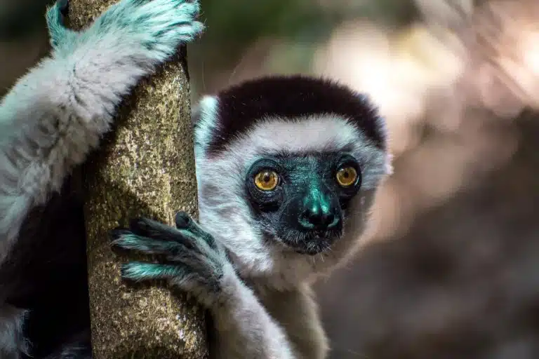
- National Park: 105,000 protected hectares, endemic fauna and flora
- Diving & snorkeling: coral reef, tropical fish, shipwrecks
📸 For Photographers
- Sunrise: Piton de la Fournaise, Piton des Neiges, Maïdo
- Sunset: Cap Méchant, Grande Anse, Saint-Leu, Saint-Gilles
- Waterfalls: Bridal Veil, Takamaka, Bassin la Mer
- Creole villages: Hell-Bourg, Entre-Deux (traditional houses)
- Helicopter flights: overfly the cirques and volcano
🍽️ For Foodies
- Local markets: tropical fruits, spices, farm products
- Rum distilleries: tasting of arranged rums
- Creole restaurants: authentic curries, rougails, achards
- Cilaos vineyards: high-altitude wine (unique in France)
- Local catch: fresh fish on Saint-Pierre waterfront
Towns & Regions to Explore (North • West • East • South)
North
- Saint-Denis: capital, Creole houses, Jardin de l’État, museums, Barachois.
- Sainte-Marie: Roland-Garros Airport (RUN), family-friendly coast, markets.
- Sainte-Suzanne: Bel-Air lighthouse, Niagara waterfall, sugarcane fields.
- Saint-André: Tamil temples, spices and vanilla; vibrant Indo-Reunionese culture.
West
- Saint-Paul: large bay, street market, gateway to beaches and Maïdo.
- La Possession: starting point Rivière des Galets to Mafate.
- Le Port: commercial and cruise port, street art murals.
- Les Trois-Bassins: ridge trails and lagoon viewpoints.
- Saint-Leu: Stella Matutina, Kélonia (turtles), paragliding.
- Saint-Gilles-les-Bains (Saint-Paul): ideal base for beach & lagoon, water activities.
East — “Windward Coast”
- Saint-Benoît: Rivière des Marsouins, gateways to Takamaka.
- Bras-Panon: vanilla and agricultural fair.
- Sainte-Anne / Sainte-Rose: Notre-Dame-des-Laves, coastal lava flows, colorful churches.
- Salazie: lush cirque, Hell-Bourg, humid forest trails.
- La Plaine-des-Palmistes: Bébour–Bélouve forests, highland freshness and primary forests.
South
- Saint-Pierre: lively waterfront, restaurants, base for the wild South.
- Le Tampon: Plaine des Cafres, access road to la Fournaise.
- Saint-Louis: Rivière Saint-Étienne valley, crafts.
- L’Étang-Salé: black sand beach, coastal forest and dunes.
- Les Avirons: West Coast viewpoints, ridge paths.
- Petite-Île: Grande Anse, protected coastal views.
- Saint-Joseph: Langevin – Grand Galet and its pools.
- Saint-Philippe: Cap Méchant, Puits des Anglais, recent lava flows.
- Entre-Deux & Cilaos: traditional houses, balcony trails and high ridges.

Nature, Biodiversity & Ecotourism
Reunion Island National Park protects a natural heart where tamarin trees, colorful woods, tree ferns (fanjans), pandanus and ambavilles thrive. Along the coast, the marine reserve shelters reefs, seagrass beds, and tropical fish.
Eco-practices: stay on trails, don’t pick anything, take your waste, choose committed guides and accommodations, use reef-safe sunscreen, don’t walk on coral.
Creole Culture & Experiences
Reunionese Creole culture was born from African, Malagasy, Indian, European, and Chinese blending.
- Maloya — inscribed on the intangible cultural heritage list (2009). Played during kabars with the sound of the roulèr (drum) and kayamb (flat rattle), it expresses the island’s soul.
- Traditional festivals: Dipavali, Cavadee, Tamil processions, religious and secular celebrations year-round.
- Flavors & local products: curries, rougails, samosas, chili fritters, rums, vanilla, tropical fruits; markets in Saint-Paul and Saint-Pierre.

Reunion Island Itinerary Ideas
7 days — the essentials at a relaxed pace
- D1 — Saint-Gilles-les-Bains: settle in, lagoon beach, sunset.
- D2 — Maïdo → viewpoint: panoramas over Mafate.
- D3 — Cilaos: scenic road, ridge walk, thermal baths or easy canyon.
- D4 — Salazie & Hell-Bourg: traditional houses, Bridal Veil, Bélouve forest (Trou de Fer viewpoint).
- D5 — Piton de la Fournaise: Pas de Bellecombe–Jacob; hike in the enclosure if authorized.
- D6 — Wild South: Route des Laves, Cap Méchant, spice garden; stop at Langevin – Grand Galet pools.
- D7 — Saint-Pierre (waterfront) then Saint-Denis (houses, museums) before return flight.
14 days — balanced grand tour
West 4d → Cilaos 2d → Mafate 2d (guesthouse) → Volcano 2d → Wild South 2d → Salazie/North 2d.
21 days — explore without rushing
West base 5d → Cilaos 3d → Mafate 3d → Salazie 3d → Volcano / Plaine des Cafres 3d → Wild South 2d → North 2d.
(The average observed stay is about 20 days: perfect for alternating hiking, beaches, and cultural discoveries.)
Practical Information for Reunion Island
- Official language: French and Creole
- Status & formalities: Reunion Island is a French overseas department (Euro, 230V / 50Hz, type E plugs). For French citizens, valid national ID card. For other nationalities, verify passport and entry requirements before departure (the island is outside the Schengen area).
- Access: flights to Roland-Garros (RUN) in the North (Sainte-Marie / Saint-Denis) and Pierrefonds (ZSE) in the South (Saint-Pierre).
- Getting around: car rental recommended; intercity buses; Mafate has no roads (foot/helicopter access).
- Hiking: changing weather, leave early, water and warm clothing; marked trails; check trail conditions and any closures (volcano, floods, rockfalls).
- Swimming: favor the lagoon and supervised beaches; strictly follow signage.
- Health: no special vaccination requirements from mainland France; sun protection, hydration, caution in mountains and ravines after rain.
FAQ
Can you hike Piton de la Fournaise year-round?
Yes, if the enclosure is open. Access is regulated; follow markings from Pas de Bellecombe–Jacob and check conditions the day before.
How do you get into Mafate?
Via Col des Bœufs, Maïdo, or Rivière des Galets. Bring water, good physical condition, and ideally plan an overnight in a guesthouse.
Where can you swim safely in Reunion Island?
In the West lagoon (L’Ermitage, La Saline, Trou d’Eau, Saint-Leu, Saint-Gilles-les-Bains) and on supervised beaches when swimming is authorized.
Is Reunion Island suitable for families?
Yes: calm lagoon, accessible pools, fun museums (Cité du Volcan, Kélonia, Stella Matutina), boat trips, colorful markets.
How many days should you plan for Reunion Island?
A well-structured 7-day trip covers the essentials; two to three weeks allow for Mafate trekking, more nature activities, and beach time.
Ready to plan your Reunion Island trip? Between an active volcano, UNESCO-listed cirques, beaches & lagoon, Creole traditions, and ecotourism, this intense island offers a grand tropical journey — at your own pace, year-round. Find selected offers here
The Vanilla Islands